Acequias of the Tucson Basin
There once were many prehistoric and historic irrigation canals or acequias in the Tucson Basin that would use gravity to more widely distribute perennially and ephemerally flowing water from rivers such as the Santa Cruz and Rillito and creeks such as the Tanque Verde to agricultural fields within the waterways’ floodplains.
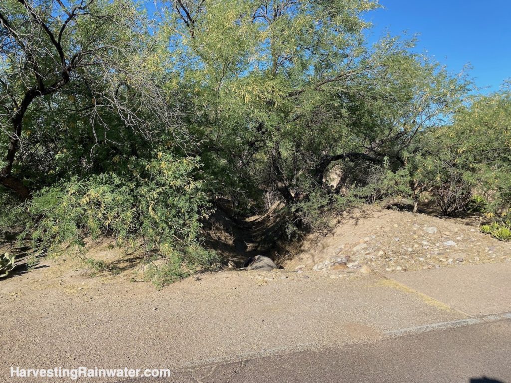
Photo: Brad Lancaster, 5-13-22

Photo: Brad Lancaster, 5-13-22
Studies from New Mexico State University, such as Acequias of the Southwestern United States: Elements of resilience in a coupled natural and human system have found that this traditional type of irrigation (keeping diverted surface waters within the floodplain of the surface water source) can reduce flooding in the wet times, help recharge groundwater, and extend surface flow within the waterways longer into the dry times (as the diverted water infiltrates into the soil and slowly seeps back out into the original waterway.
This is very different than extractive pumping of groundwater from the aquifer to irrigate fields well outside of the floodplains of waterways where most groundwater recharge occurs.
As the over pumping of our groundwater increased, and we also altered the watershed in a way that reduced rainwater absorption and groundwater recharge (by replacing absorbent native vegetation and topsoil with buildings and pavement for example), we killed the surface water flows that fed these gravity-fed irrigation canals.
You can still see some of these acequias if you know where to look.
A Thousand Years of Irrigation in Tucson by Jonathan B. Mabry and J. Homer Thiel, Center for Desert Archaeology is a great resource. Look within that resource to find old maps of many irrigation ditches.
The Mercado District development laid its streets atop some of the old ditches to bring their old paths to light (or to street) in a sense.
Better still, the Old Fort Lowell Neighborhood Association has been working with others to actually restore water to its historic Corbett Irrigation Ditch between East Fort Lowell Road and the Rillito River.
Even if water from the Tanque Verde Creek were not continue to flow down the ditch, stormwater runoff from surrounding streets large like Craycroft, and small like adjoining neighborhood streets, could at least be directed into the ditch, instead of storm drains and arroyos draining the the water straight back to the Rillito River bed.
As stated in “A Ditch Flows Through It: Restoration of the Corbett Irrigation Ditch in the Old Fort Lowell Neighborhood” from the Fall 2021 newsletter of the Old Fort Lowell Neighborhood Association:
“The Ditch was built in the early 1860s during a very difficult time for Mexican and American farmers and ranchers in the Tucson Basin. The Basin and other lands had been sold just ten years prior by a young Mexico to a young U.S. The U.S military was mostly withdrawn during the Civil War, and long-term problems between settlers and Apaches were continuing to boil over.
However, the Rillito Valley in the northeastern Tucson Basin with anciently abandoned floodplains of mixed loamy soils was considered a fertile agricultural area. The Corbett Irrigation Ditch, named after prominent resident and Mayor J. Knox Corbett, with a dozen other acéquias, provided water for agriculture from the Tanque Verde west to Alvernon Way. The gravity-fed Ditch irrigated farmer’s crops for 80 or 90 years into the 1950s. Even as agriculture gave way to residential development, it continued to be maintained and flowed another 50 years, at least seasonally, until about 2000 when it stopped flowing and nobody knows for sure why.”
The ditch can still be seen on the southern border of the campus of The Gregory School on/from the west side of Craycroft road, and within the Placita Del Mesquite subdivision.
See the July 3, 2021 Arizona Daily Star article, “Dry irrigation ditch could hold key to restoring historic Tucson mesquite grove” by Henry Brean for a map and photos.
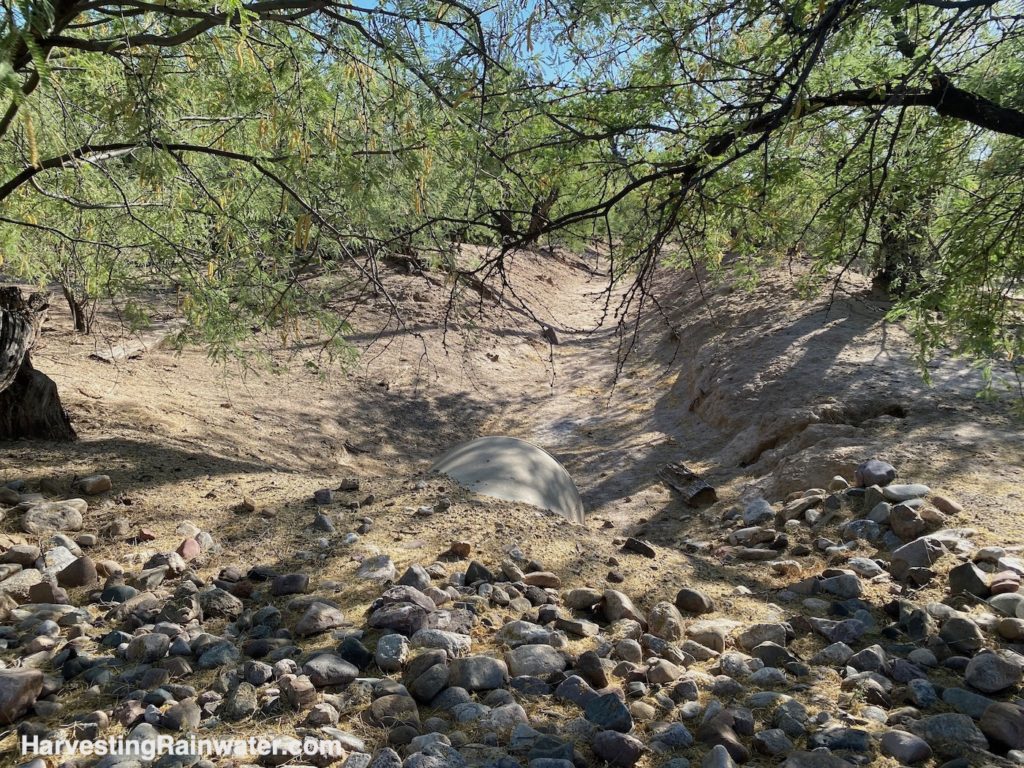
Photo: Brad Lancaster, 5-13-22
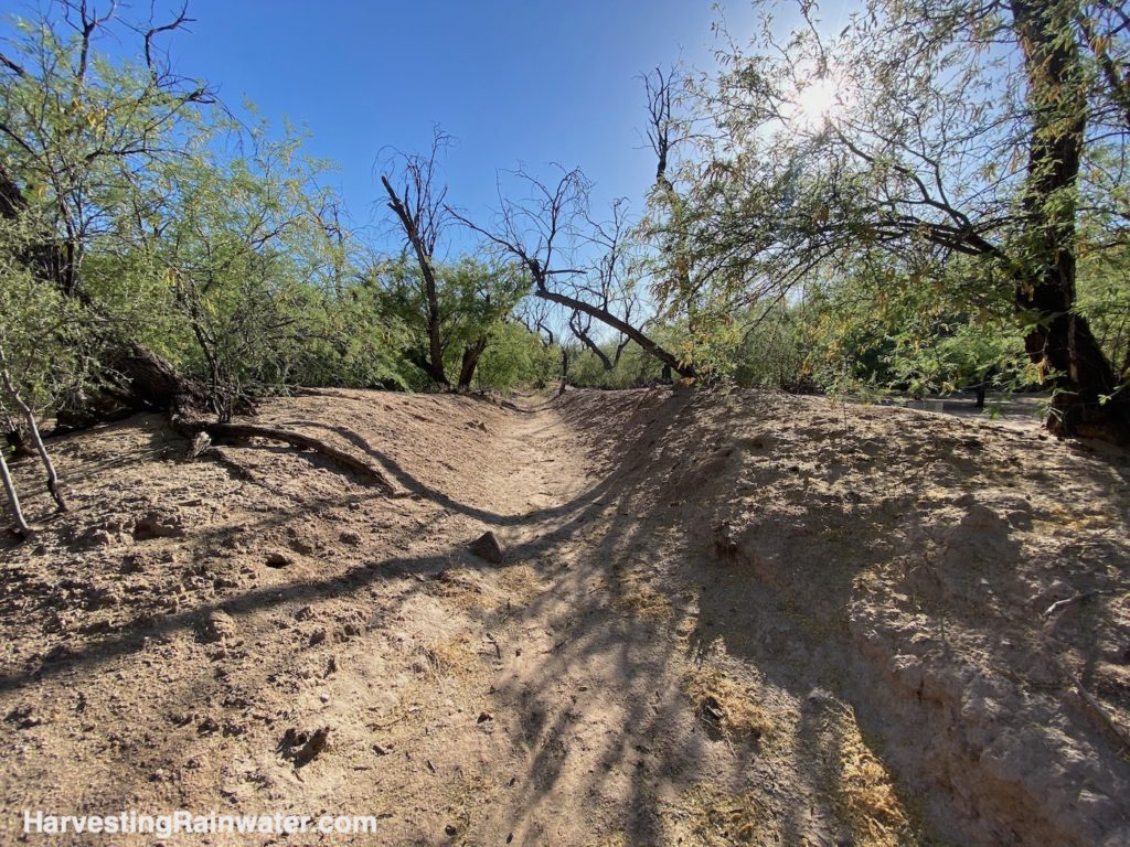
Photo: Brad Lancaster, 5-13-22
Where:
From N. Craycroft Road, turn west on E Placita Del Mesquite, when the road turns north look for the ditch on either side of the road. It goes under the road via a culvert pipe.
You can easily see the ditch from Google Maps when using the satellite view.
32.263709, -110.876837
Cost: free
This location is included in the following tours:
See the new, full-color, revised editions of Brad’s award-winning books
– available a deep discount, direct from Brad:
Volume 1