Monsoon flood flow watch tower along the Rillito River
Built in the 1950s, this concrete tower was one of five along the Rillito River used as lookout point to alert farmers about flood flows during the rainy seasons and runoff flows at times of snow melt from the Catalina Mountains.
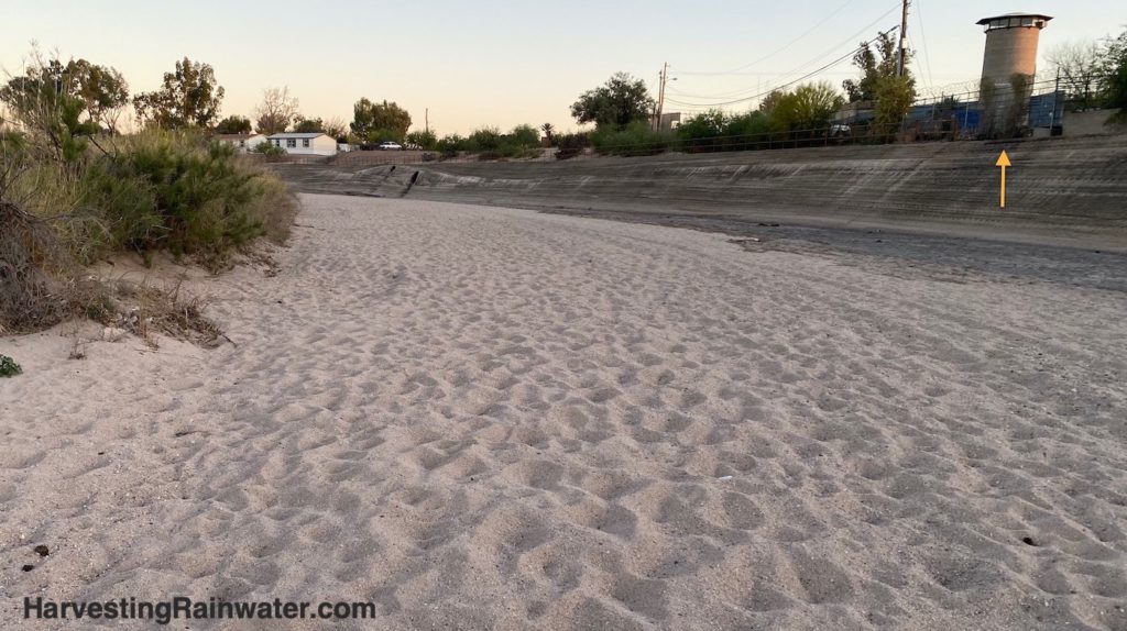
Note the steep concrete-stabilized banks of the river, and how much the river has erosively downcut to the point that is rare that flood flows can now spread out onto and rehydrate the historic floodplain where the tower and other buildings are located.
Photo: Brad Lancaster 5-2022
In the past, before the Rillito River bed erosively downcut, the elevation of the riverbed was much closer to the adjoining floodplain where many of the farms were located. Thus river water flow could much more easily be diverted onto fields, and in flood flow events river water could easily spill onto the adjoining floodplain where the water flow would spread out far, wide, and shallow; which reduced the force of the flood. The water flowing onto the floodplain also hydrated the land, recharged the groundwater aquifer, and enhanced soil fertility with the nutrient-rich sediment of organic matter, animal manure, and more which the water flow carried and then deposited upon the floodplain.
Today, much of the Rillito River’s banks have been stabilized/sealed with a concrete-soil mix, and levees have been built to keep flood flows off the floodplain in order to protect buildings and other infrastructure unwisely built within the historic floodplain. The pavement inhibits infiltration of water into the soil, while absorbing heat from the sun and increasing soil moisture loss to evaporation. Such practices contribute to the dehydration of our community.
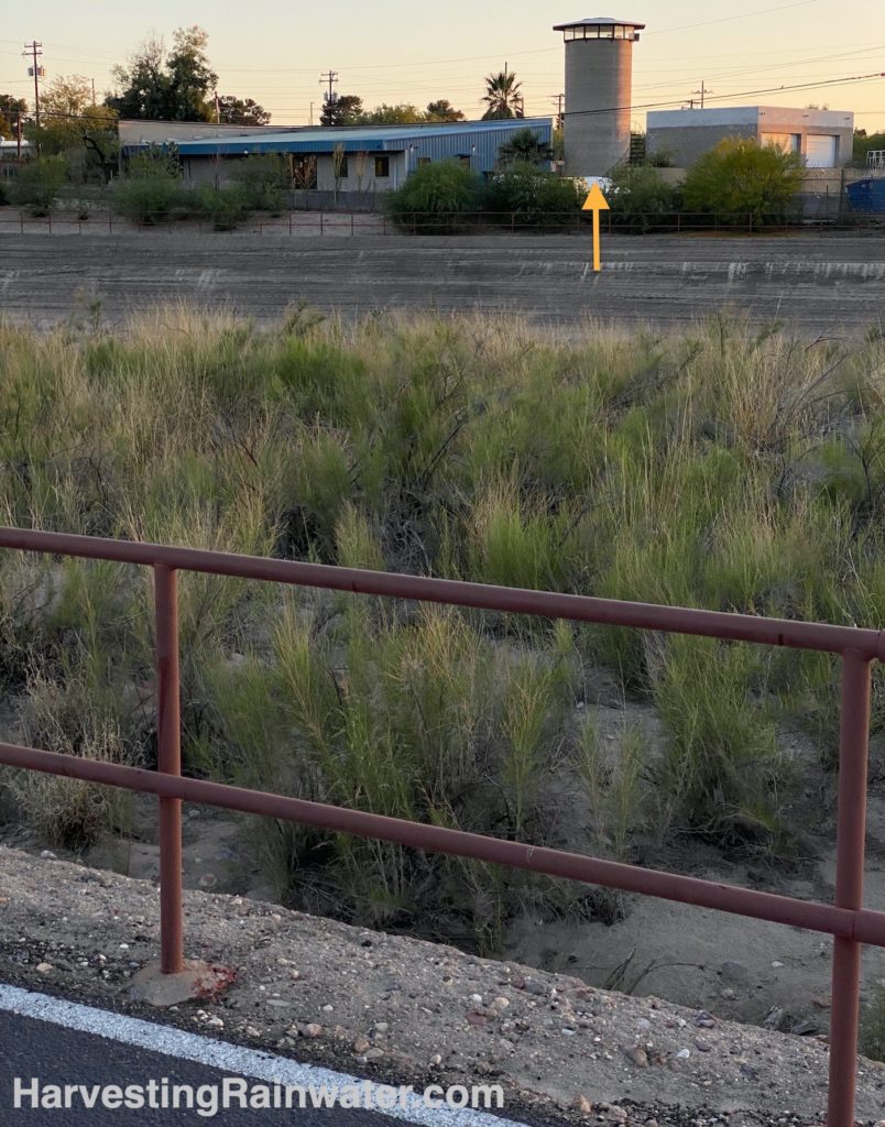
Orange arrow points out the watch tower.
Photo: Brad Lancaster, 5-2022
For historic infrastructure on this tour that used to help spread river flows out of the river bed an onto the adjoining floodplain see the Acequias of the Tucson Basin
Where:
Public view point of the watch tower is on the Rillito River Park path just south of the back lot of Green Things Nursery property. Once there look due west across the river to see the tower.
32.2727709274164, -110.9254903179483
Hours: The tower is NOT open to the public. It is on private property, and the owner does not want Tower sight-seers on property, nor blocking property access.
So, if you want to view the Tower, do so from the public Rillito River Park path (accessible by bicycle or foot) on the northeast side of the river. Map coordinates are for the point from which you can look to view the tower. Once there, look west to the tower. The Rillito River Park and its paved path are open 6am – 10pm.
Cost: free
Pets allowed on leash
For more information on the watch tower, see the October 24, 2014 Arizona Daily Star article “Tucson Oddity: Old Tower Once Used for Storm Alerts” by Yamar Younger
This location is included in the following tours:
See the new, full-color, revised editions of Brad’s award-winning books
– available a deep discount, direct from Brad:
Volume 1