Watershed Maps Are Community Maps
by Brad Lancaster
www.HarvestingRainwater.com
A watershed is “that area of land, a bounded hydrological system, within which all living things are inextricably linked by their common water course and where, as humans settled, simple logic demanded that they become part of a community.”
— John Wesley Powell
Political boundaries are arbitrary. Watershed boundaries are real.
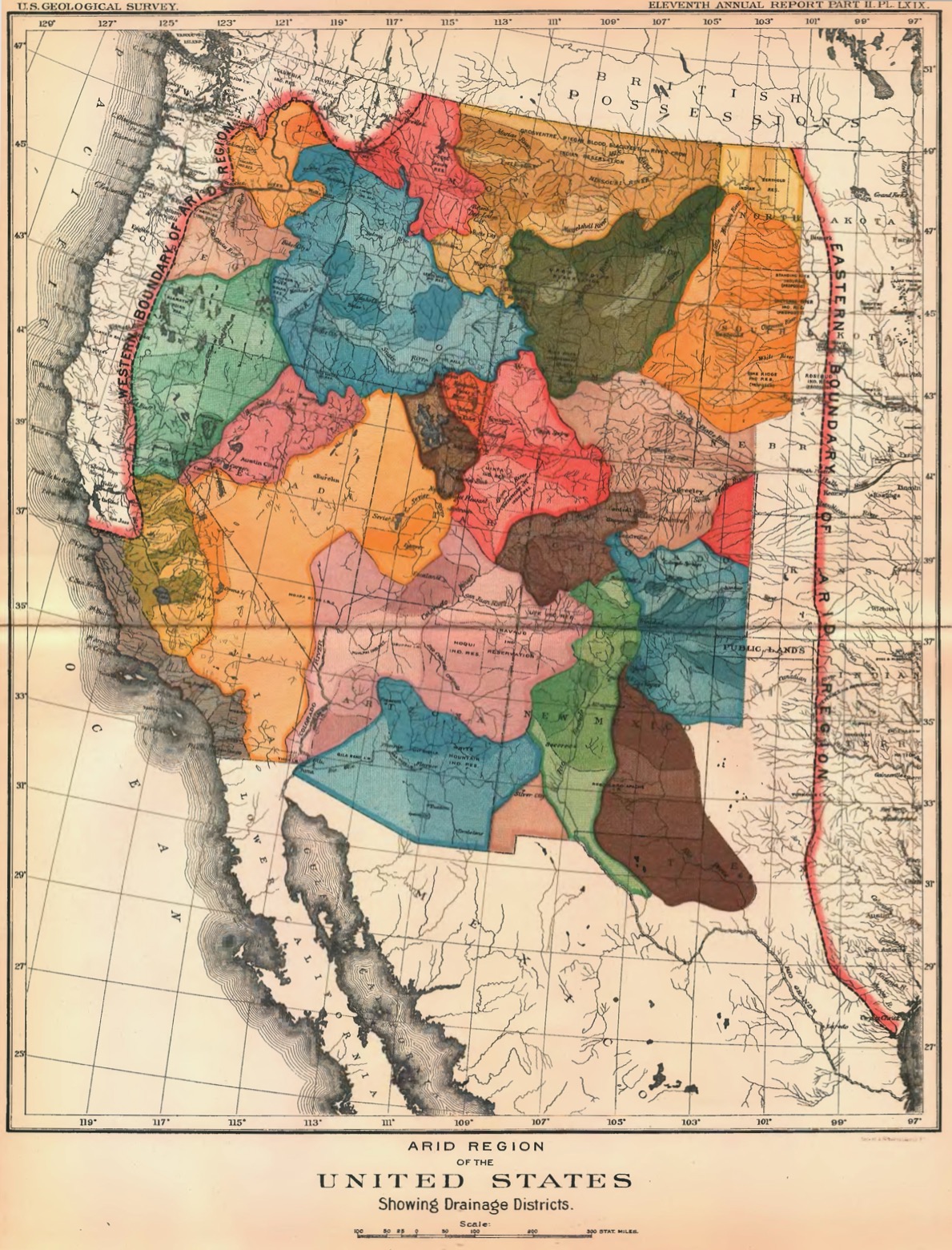
See below for John Wesley Powell’s 1890 map of the “Arid Region of the United States, showing Drainage Districts.”
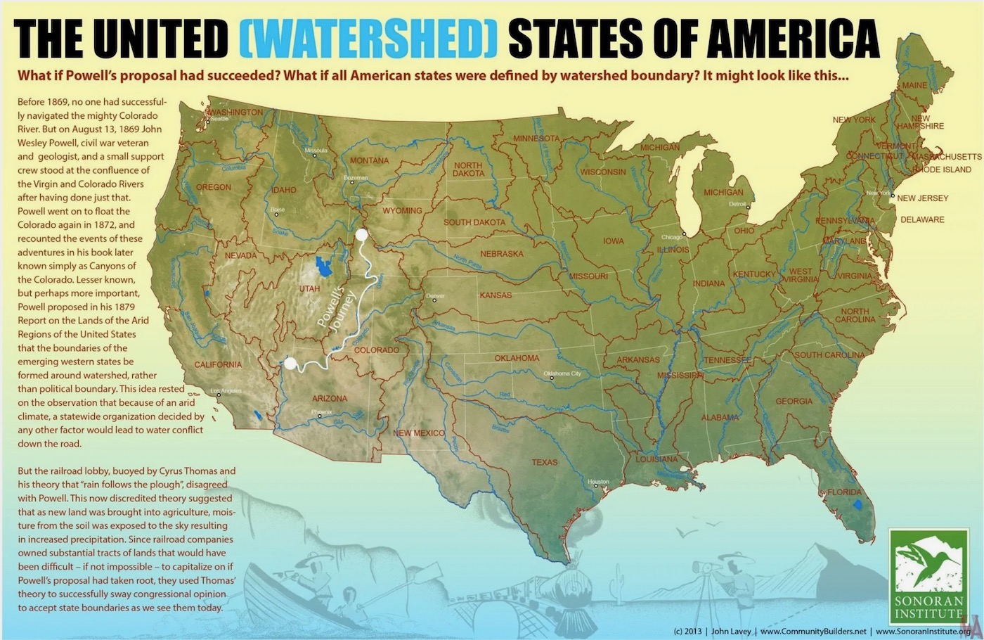
Click here for another version of the United Watersheds of America map.
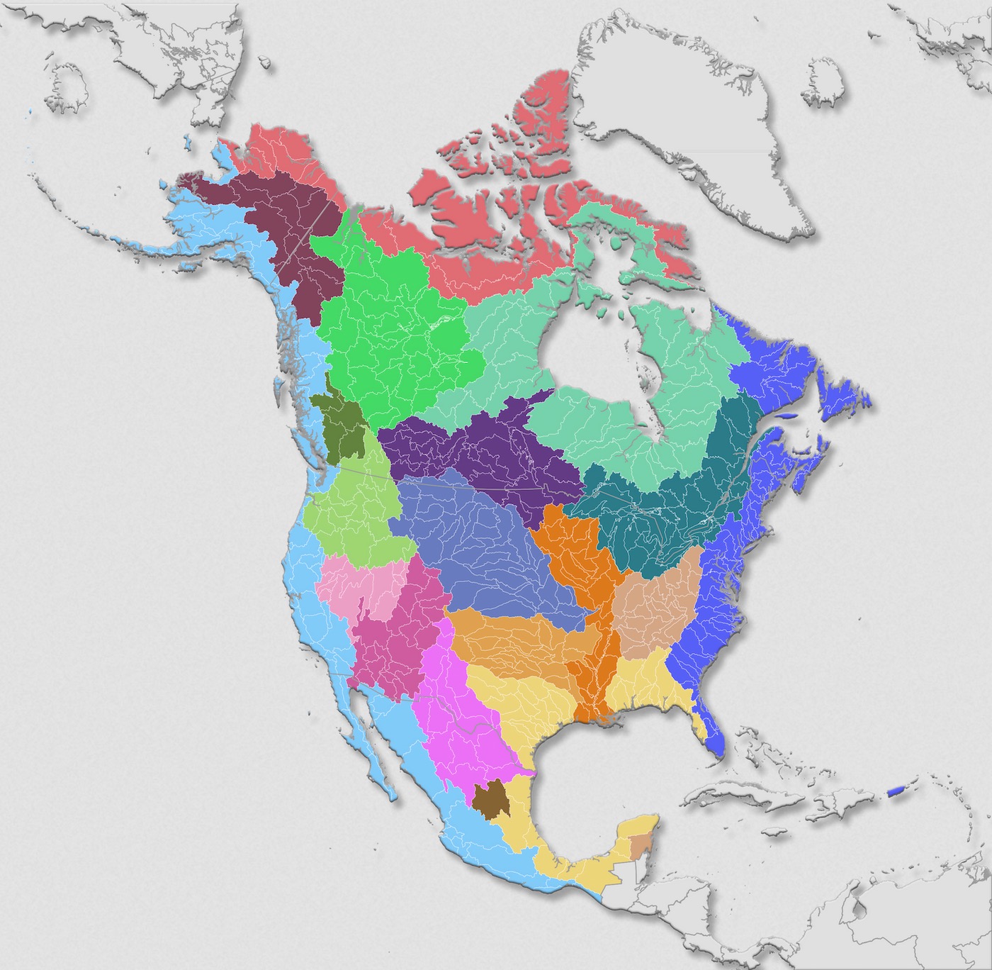
https://www.usgs.gov/media/images/watershed-map-north-america
Neighborhood watershed maps
What watershed (or smaller subwatershed), what naturally bounded community, do you live within?
Have you walked, run, biked, danced, kayaked it in a big rain?
Have you watched the water flow, its volume, its quality, its source, and its destination?
I recommend you do. You will better know the Place you live within. You will better know the community to which you are connected, and with which you could connect better still.
Below are examples of how some communities are encouraging the strengthening of this connection.
Excellent watershed maps are available for Oakland and Berkeley, CA, showing current and historic boundaries and conditions.
The even more-elaborate Mannahatta project shows us what Manhattan looked like in its natural state (in 1609) before the city was built.
Watershed Management Group, with TerraSystems Southwest, has made a some great Tucson Basin Watershed Maps.
You can use these resources to make signs that highlight your neighborhood’s or community’s watershed(s).
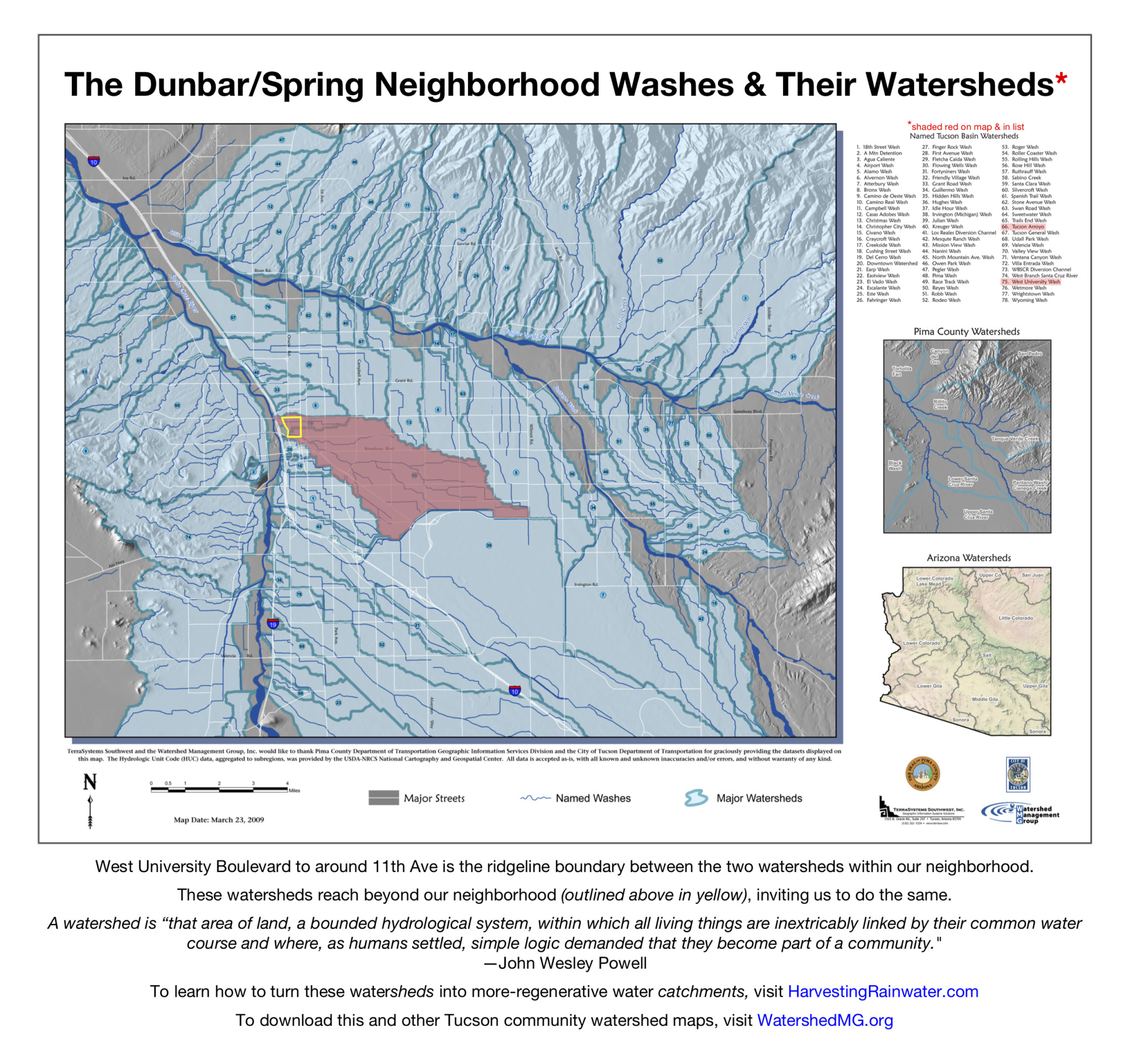
This 17″ x 16″ all-weather reflective aluminum sign was made for $42 at a local sign shop in Tucson. We provided the pdf image, they made the sign, and we posted it on the Dunbar/Spring community bulletin board on the southeast corner of 9th Ave and University Blvd.
Click to download the JPEG of this Dunbar/Spring Washes and Watersheds sign.
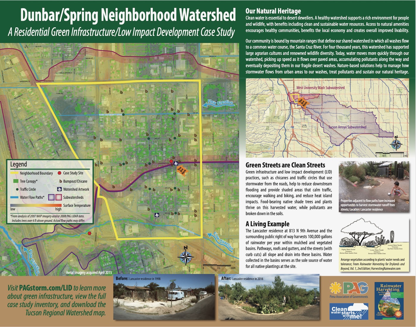
I collaborated with Mead Mier and Melanie Alvarez of the Pima Association of Governments (PAG) to elaborate on this map to create the one below. To see how you can make a similar map see here.
Watershed signage programs
Santa Cruz County, in California, is one municipality that places watershed signs where roads cross over watershed boundaries/ridgelines.
This was a follow up to a watershed road-signage project in Sonoma County conceived of by Brock Dolman and the Water Institute, funded by the State Coastal Conservancy, and partnered with the Southern Sonoma RCD. Download the how-to guide: Creek Signs: Guide to Developing a Local Watershed and Creek Signage Program.
These efforts help show the flow, instead of obscuring it within drain pipes and other hidden infrastructure, so we can better celebrate the flow, and enhance it and the watershed by turning draining watersheds into harvesting-water catchments.
For images of examples you can also check out my Water Harvesting Image Galleries.
Also check out Brock Dolman’s excellent Basins of Relations booklet, and while you’re at it check out his wonderful watershed presentation.
More watershed maps for the U.S. and other parts of the world
For maps of major watershed boundaries in South America and Europe, click here.
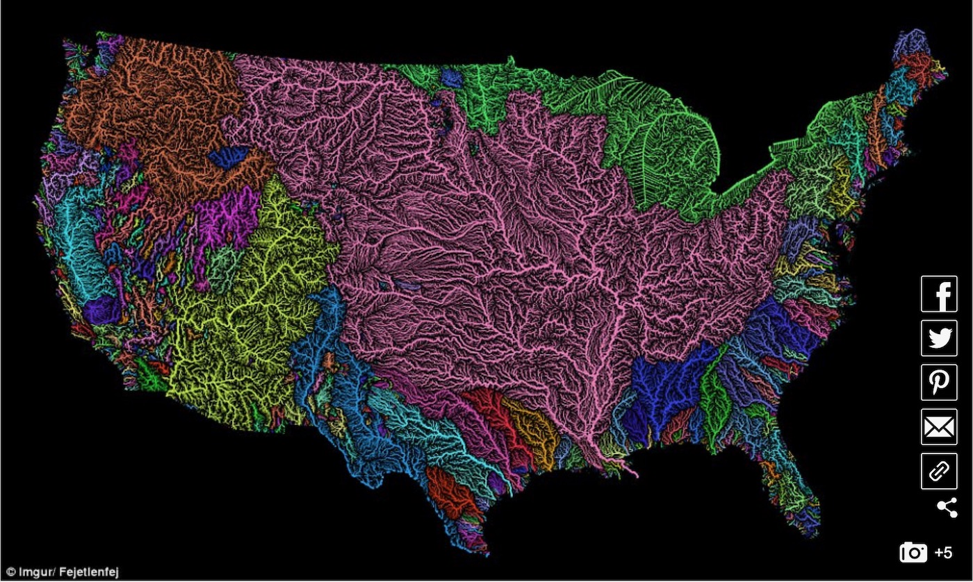
Check out the Veins of America watershed maps by Fejetlenfej, showing the vein-like network of rivers and streams in the continental 48 U.S. states.
For more on how we can do this on our own sites and within our own neighborhoods…
See the new, full-color, revised editions of Brad’s award-winning books
– available a deep discount, direct from Brad:
Volume 1