Harvesting Rainwater for Hikers, Wildlife, Livestock, Oases, and More
By Brad Lancaster © 2019
HarvestingRainwater.com
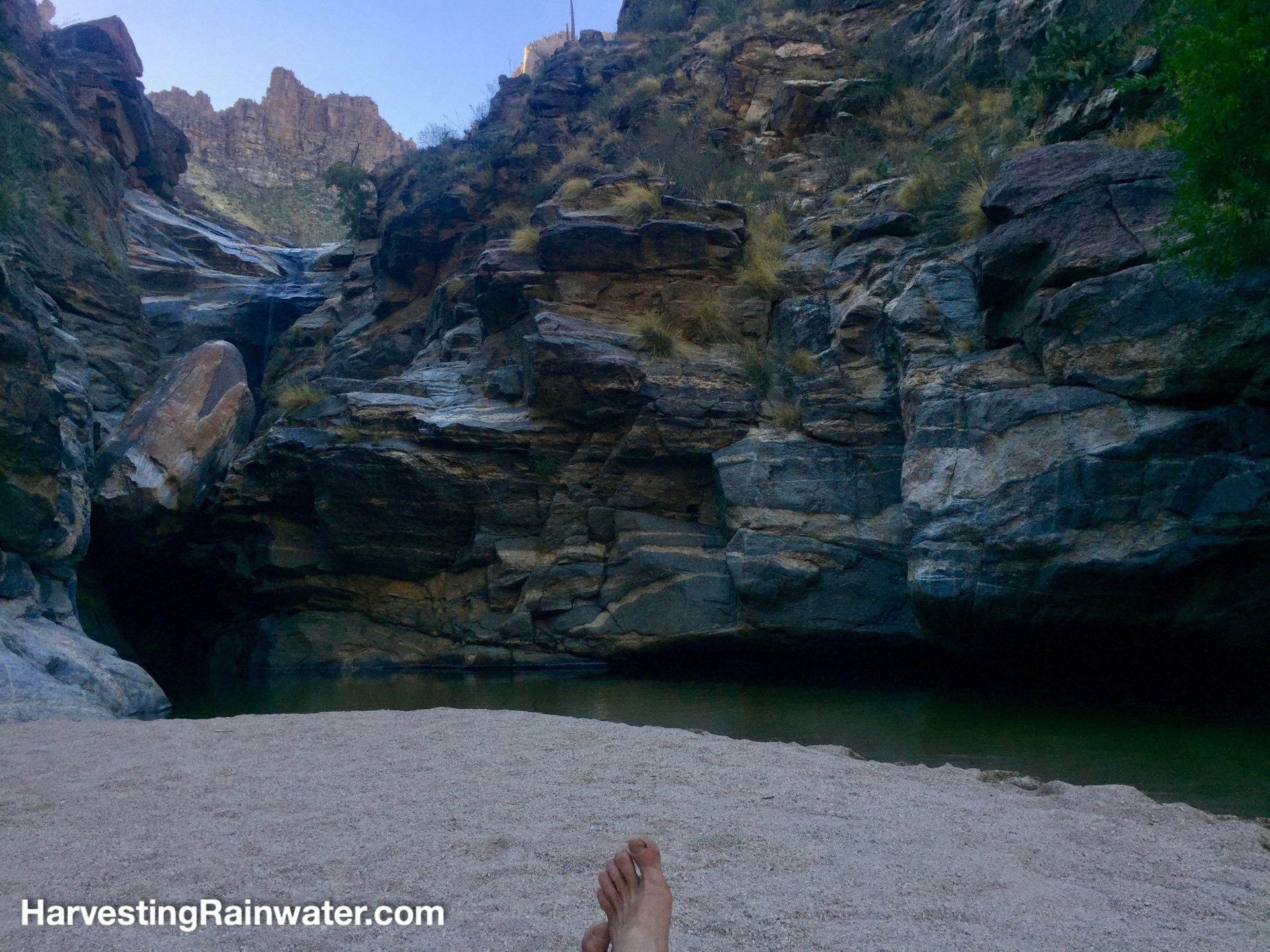
I love water and seek it out when I hike—especially tinajas, natural water pools in the desert. Such ephemeral pools can be created with simple strategies in dry areas where they don’t already exist. Similarly, rainwater tanks coupled with small catchment roofs can provide water that can last year round; existing pools can be enhanced with simple rockwork; and the diversity and density of vegetation can be dramatically enhanced for wildlife and livestock with simple water-harvesting earthworks that divert water from areas where it is problematic (such as trails and roads) to adjoining areas where it can create a beneficial oasis. Interested?
Read on!
Rainwater catchment for otherwise fresh water-less areas
This year the Arizona Trail Association installed a pilot 1,500-gallon (5,600-liter) rainwater collector on a dry 21-mile segment of the cross-state trail that had previously been daunting for many hikers, runners, mountain bikers, and equestrians.
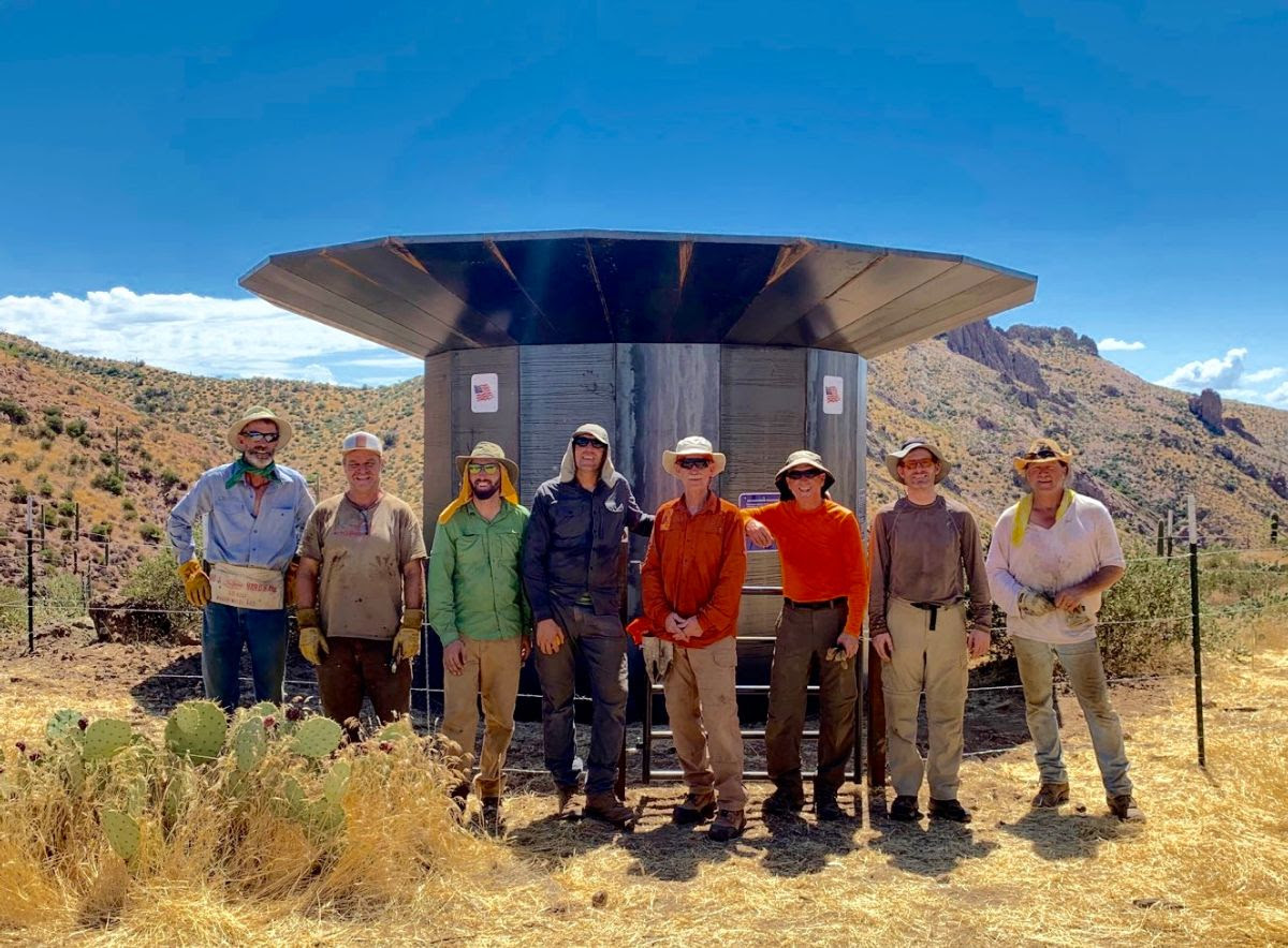
Photo courtesy of the Arizona Trail Association.
According to the Arizona Trail Association,
“Covering the distance without any shade or water was previously prohibitive for those on horses as the animals require 5-7 gallons of fresh water per day. This passage had also been the site of many Search and Rescue operations when trail users got into trouble from dehydration and heat exhaustion. The system was designed by the Arizona Trail Association, and metalsmith Rob Bauer in consultation with sustainability professionals, land managers and engineers. It features a steel apron roof that catches rainwater and stores the precious resource within a tank that protected on all sides by steel panels. A spigot with an automatic shutoff valve allows trail users to fill and filter their water bottles. Once the tank is full, an overflow pipe fills a steel water trough nearby for the benefit of wildlife. Posted signs inform trail users that the water must be filtered before consumption.
The AZT Rainwater Collector is located ¼-mile east of the trail (near AZT mile 288.6 – Ajax Road). Since it is not visible while on the trail it doesn’t detract from the Arizona Trail’s scenic values. It sits at ground level and little disturbance was necessary for its installation, unlike wildlife water projects that require a large footprint and significant ground disturbance. The steel panel construction is literally bulletproof, and the structure also provides shade in an otherwise shadeless desert mountain range.
Water quality will be studied over a period of one year by University of Arizona students, and the results will be shared on the ATA website. Since rainwater is essentially distilled and the unit features a three-stage screen system, it’s unlikely any natural contaminants will find their way into the storage tank. The water never receives direct sunlight, so algae will not grow.
After studying this pilot project for one year, the ATA will consider fabricating and installating other Rainwater Collectors along the driest segments of the AZT.”
For more info on this system see https://aztrail.org/azt-rainwater-collector/
My first experience with human-made rainwater catchments along hiking trails was at Hawai’i Volcanoes National Park, Big Island, Hawaii.
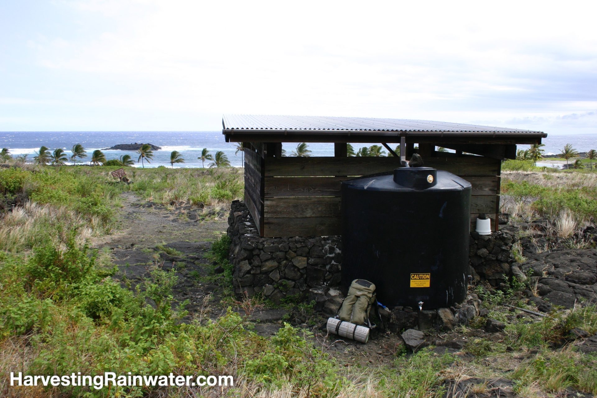
The simple catchments are spaced about 10 miles apart, and are located at primitive campsites accessible only by foot or sea. The harvested water was wonderful, and deepened my connection and appreciation to the place and this planet. I watched the sky to assess the weather, my water accessibility, and the incredible night sky where endless stars and the Milky Way continued from the sky into the reflective tranquil waters of the camp-side bay. I swam with sea turtles, explored the tide pools, and eventually hiked on to another rain-sourced oasis. It was a pleasure to know that the captured water was not extracted and pumped from elsewhere at great cost and its capture did not harm or deplete the local water cycle and environment.
See chapter three of the new full-color edition of my book “Rainwater Harvesting for Drylands and Beyond, Volume 1, 3rd Edition” for Ten Cistern System Principles that enable you to design and build more effective, multi-functional, high-quality water tank systems.
Creating and enhancing seep springs and ephemeral pools with simple water- and sediment-harvesting rockworks
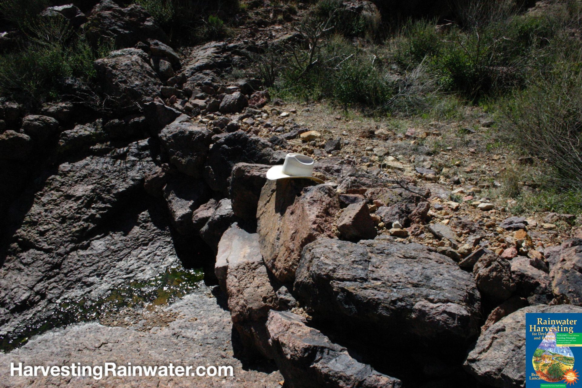
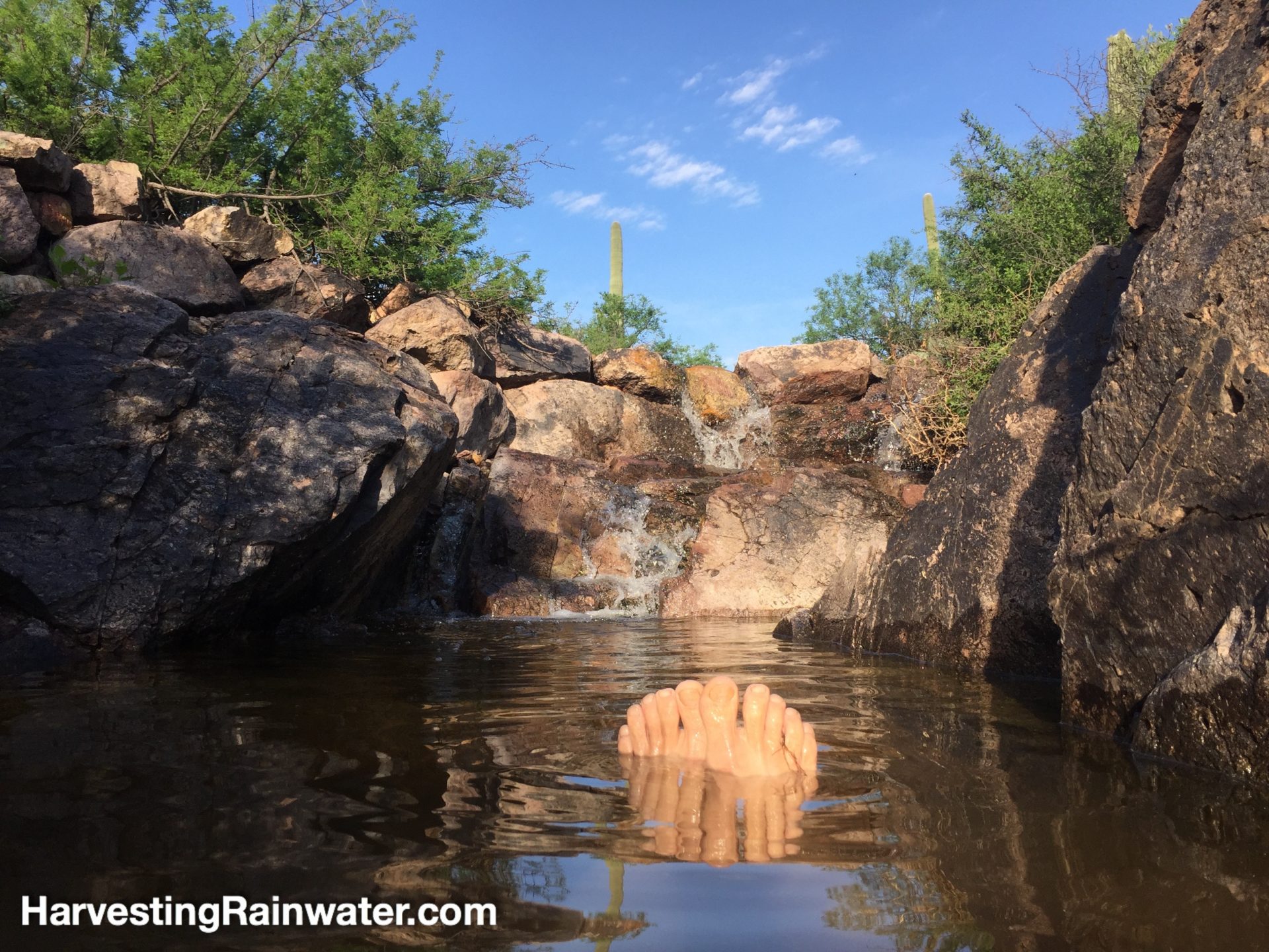
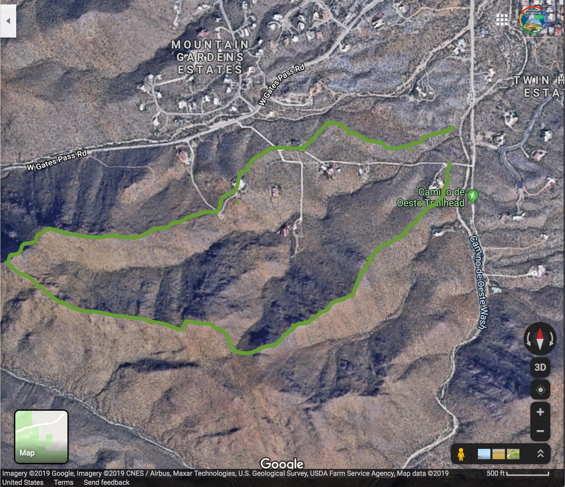
My perception of the dry, rocky Tucson Mountains on the west side of Tucson, Arizona was forever transformed when Gail Hartman took me to what I like to call “Check Dam Creek”.
Check Dam Creek is a small ephemeral waterway with check dams hand-built by the Civilian Conservation Corps in the 1930s from the top of the watershed to the bottom. Thanks to these check dams, water in this ephemeral creek or arroyo flows after good rains much longer than any other arroyo in this desert mountain range.
Reproduced with permission from “Rainwater Harvesting for Drylands and Beyond, Volume 1, 3rd Edition.”
Ephemeral seep springs have been created by a number of the structures, and a number of ephemeral pools have been deepened just downstream of some of the rockworks. There is one pool in particular that I love to dip into in the rainy season. Thanks to repeatedly submerging myself in this creek, drinking from the check dams’ seep springs, and snacking on the riprarian monkey flower plants growing along the flowing water, I now see the Tucson Mountains not as dry, but as water abundant. And I know that with the maintenance of these existing structures (many are in disrepair), and the creation of similar, but more-effective rockworks (see next section below) the abundance could be greatly enhanced by further slowing, spreading, and infiltrating (into soil and vegetation) stormwater, which otherwise too quickly flows out of this watershed and many others throughout the Tucson Mountains.
Check dam creek is an incredible historic site that can teach us much about what is, and what is not working, with these Civil Conservation Corps water-harvesting structures. It can inform and help us evolve even more effective strategies…
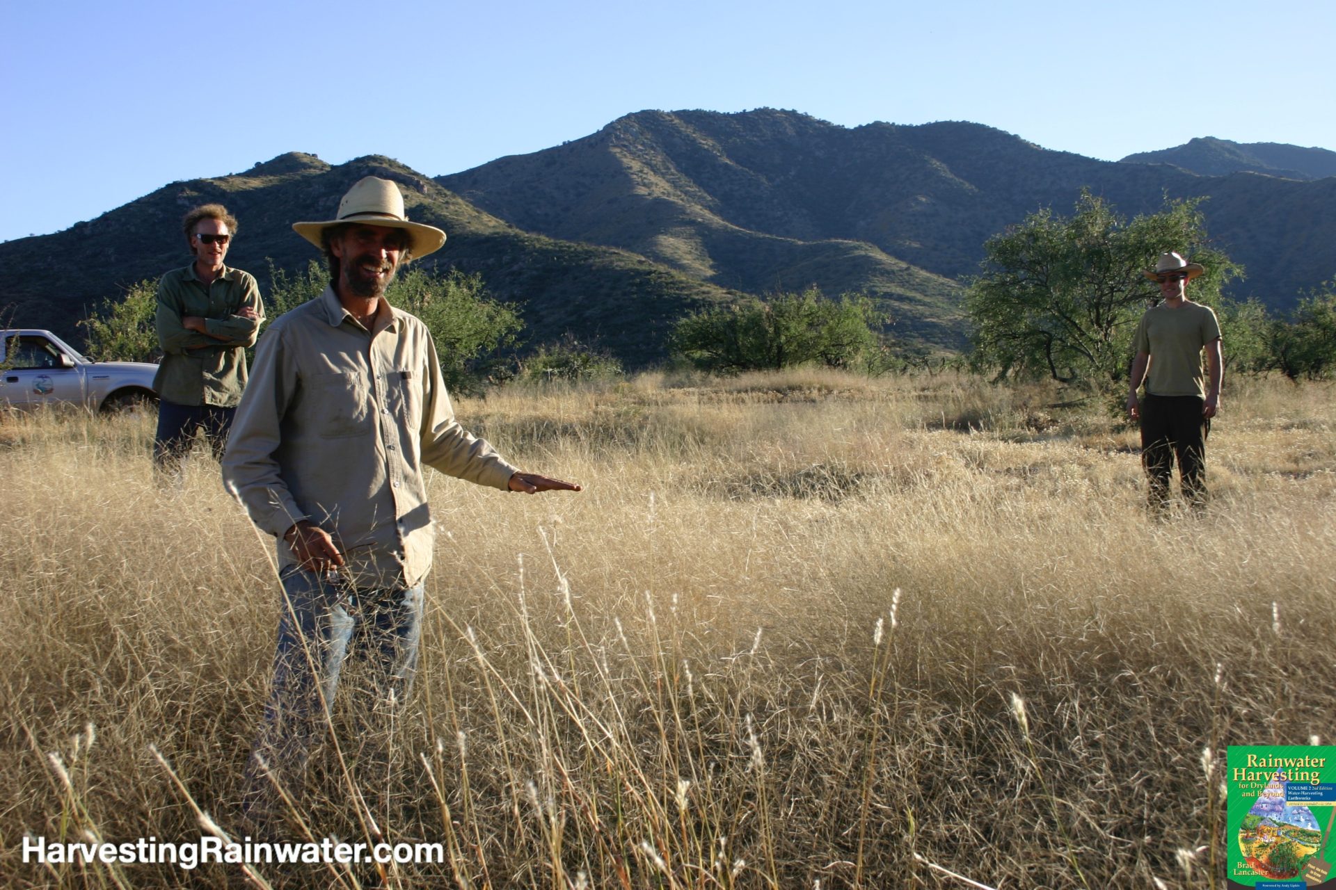
Evolved and more effective rockworks
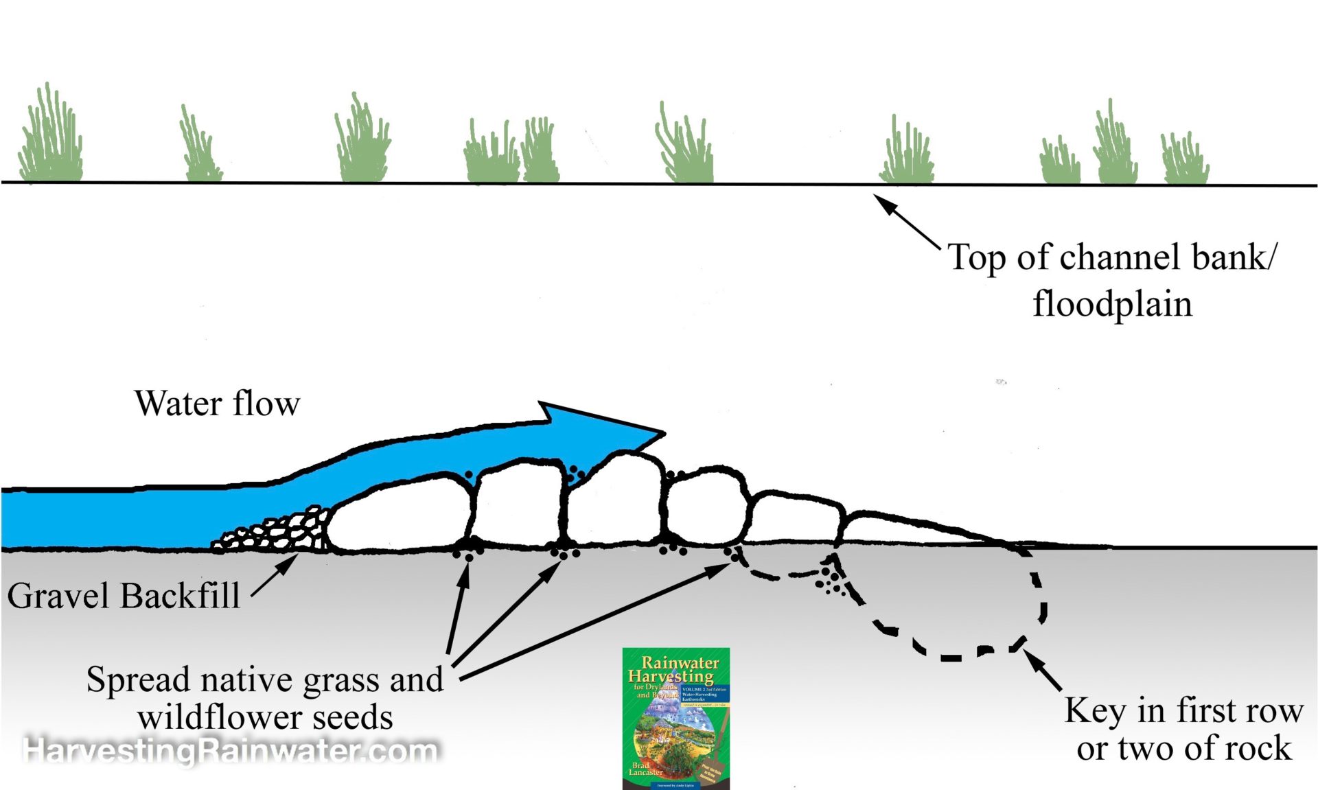
Bill Zeedyk, co-author of Let the Water Do the Work has been a wonderful mentor teaching me, and many others, how to greatly improve upon check dam structures with simpler and more wisely-placed one-rock dams, rock-lined plunge pools, cross-vanes and other structures that better work with the natural flow patterns of water and sediment.
I go into great detail on many of these evolutions and how you can better learn to see and work with natural flow patterns in the In-Channel Strategies chapter of the just-released full-color edition of my book “Rainwater Harvesting for Drylands and Beyond, Volume 2, 2nd Edition“.
These evolutions often result in smaller, easier to build, and longer-lasting structures. For example, rather than having high vertical walls like the check dams, from which water will more rapidly fall on the downstream side and create erosive scour holes (when there is no bedrock on the surface); the Zeedyk-inspired structures are lower, and have much more gradual-speed-hump-like slopes on the downslope side. So water and sediment moves more slowly and there is less likelihood of erosion and structure failure.
Reproduced with permission from “Rainwater Harvesting for Drylands and Beyond, Volume 2, 2nd Edition.”
Reproduced with permission from “Rainwater Harvesting for Drylands and Beyond, Volume 1, 3rd Edition.”
Earthworks that harvest water within living soils to grow more vegetation, habitat, food, shelter, and more
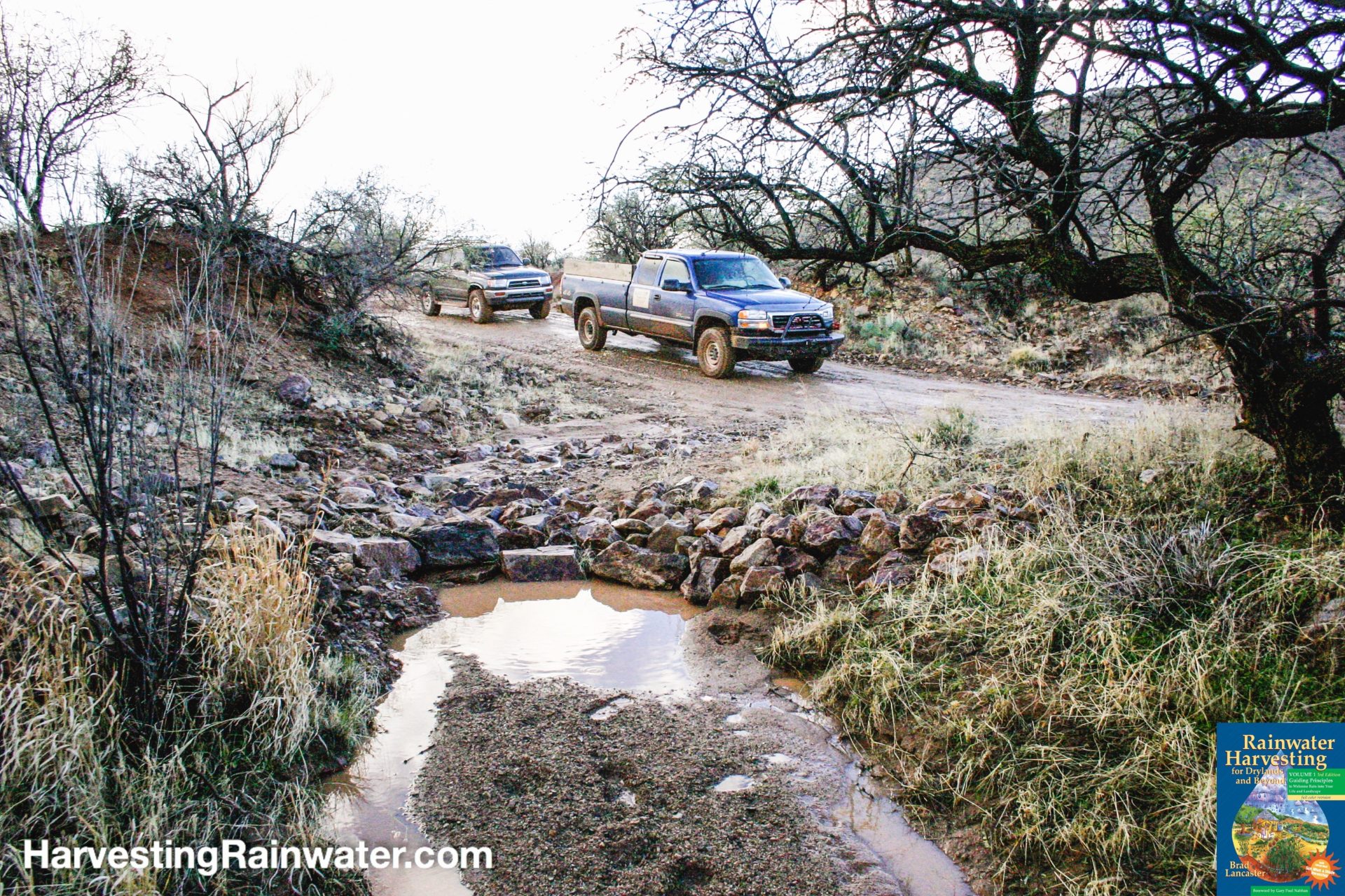
Redirecting water from surfaces where it is a liability—trails and dirt roads—to where it is a productive resource—adjoining gently sloped, vegetated land—can produce living oases of “green water” (water within soil and vegetation) which create more effective sponges that can rapidly absorb water and help recharge groundwater, while reducing downstream flooding and erosion.
Dirt roads are typically the biggest maintenance cost in rural areas as they lack vegetation that would otherwise stabilize the bare, erosion-prone soil. Poor dirt road placement, construction, and maintenance practices typically result in a dirt road lower than the surrounding landscape, more water flows into and along the dirt road causing mud bogs, dehydration of the land and vegetative die off on the downslope side of the road, increasing erosion, more maintenance needs, higher costs, and other problems.
Rolling dips are one strategy to remedy this. Unlike roadside drains alone, which can be bypassed by water that flows in wheel ruts, a rolling dip is a wide cross-drain system with a dip drain in the road, a wide lead-out ditch to the side of the road, and a wide roll-out berm on the road that forces the water into the drain and ditch.
Note: in the rolling dip context, lead-out sponge may be a better term than lead-out ditch since its purpose is to maximize the spread and infiltration of water in the landscape (not the road). This is why it is ideally wide and shallow, not narrow and deep, and is directed to vegetation—not a gully.
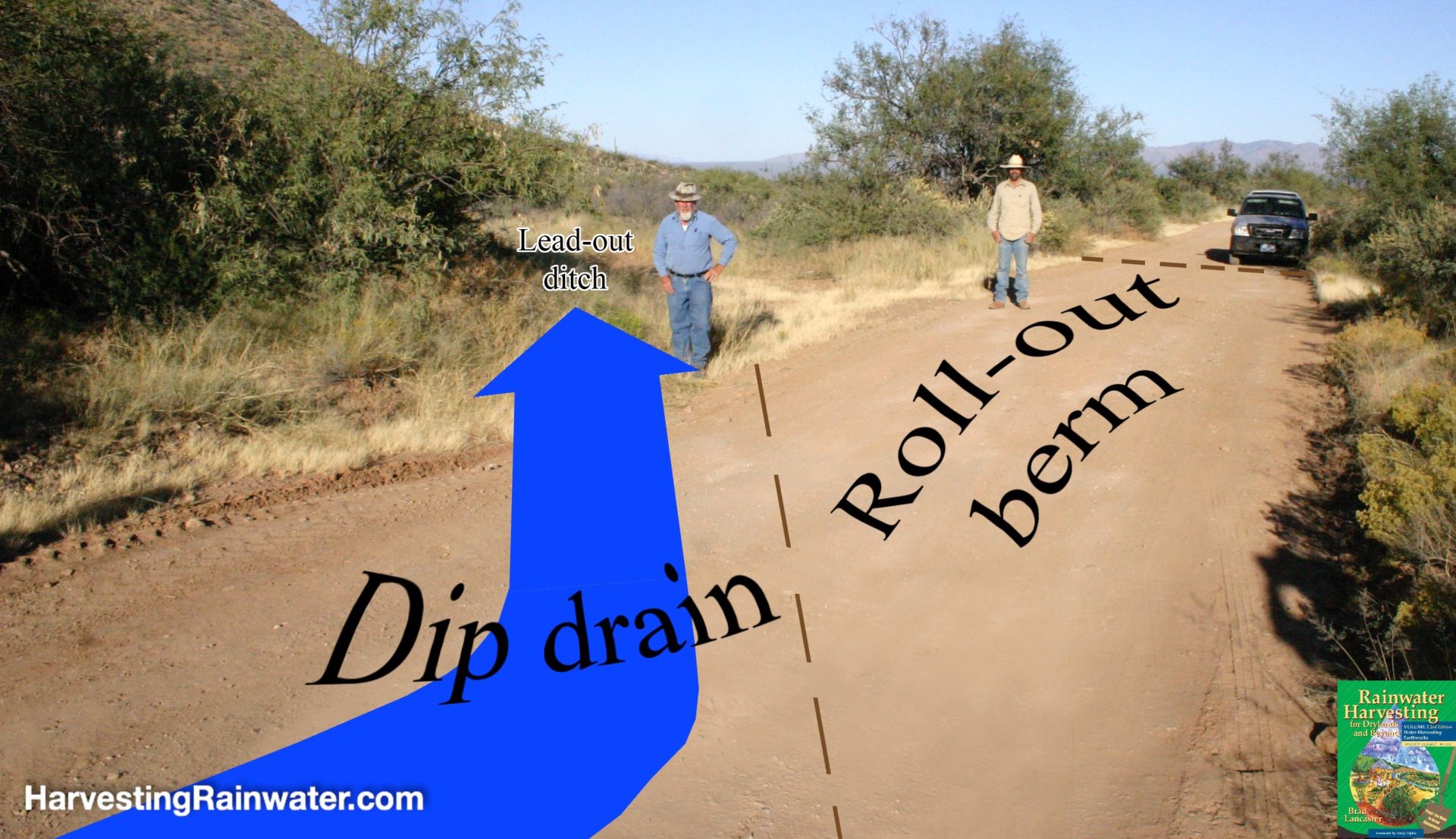
Reproduced with permission from “Rainwater Harvesting for Drylands and Beyond, Volume 2, 2nd Edition.”
Reproduced with permission from “Rainwater Harvesting for Drylands and Beyond, Volume 2, 2nd Edition.”
See the following related Drop in a Bucket blog essays by Brad:
Harvesting Rock Water and More in Kenya
Rainwater Harvesting in Puglia, Italy
For much more on how to effectively place, design, and implement the strategies discussed here
See the new, full-color, revised editions of Brad’s award-winning books
– available a deep discount, direct from Brad:

Volume 1